Ridge Route or Valley Route: Reading Two Ways Through
Compare ridge and valley routes on a map to see how terrain shapes visibility, access and the choices a journey makes across western landscapes.
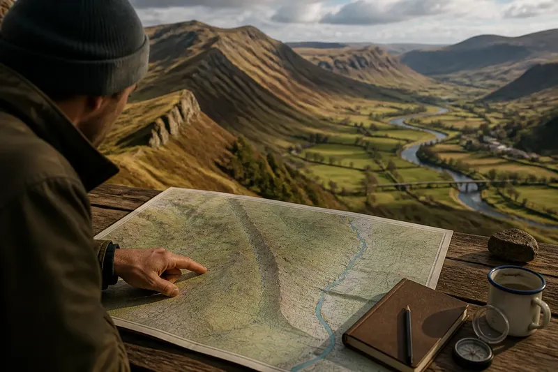
On a folded map, a ridge may look like a clean line across the country, while a valley seems to offer an easy corridor between settlements. Comparing a ridge route and a valley route is more revealing than choosing between the two: each makes different terrain visible, and each suggests a different way a journey could unfold.
Read the contours, streams, crossings and built traces together. The aim is not to declare one route more natural or more likely, but to notice what the map supports, what it leaves uncertain and which features a traveller would have had to reckon with.
1. What does the ridge line connect?
Begin with the crest, but do not treat it as a road. On a topographic map, contours that bend into a series of rounded high points can reveal a ridge spine. Trace it in both directions and note where it narrows, broadens, forks or breaks into separate summits.
A continuous crest can make a route legible over long distances: a traveller might use it to keep a general bearing, with high points serving as visible markers. Yet the line on the map may conceal awkward ground. A steep shoulder, rocky outcrop or sharp saddle can make a short section difficult, while a broad upland may offer several possible lines rather than one obvious track.
Look for places where the ridge meets another landform. A saddle can provide a lower passage between high points; a spur may lead towards a settlement or water source; a gap may connect one drainage basin to another. Those junctions matter more than the crest’s apparent straightness. They are points where a route could change direction, descend, or branch.
Also ask what the ridge overlooks. Its position may expose distant valleys, adjoining ridges or an approach from another direction. That visibility can help explain why a high route might have been useful for orientation or observation. It does not, on its own, prove that a particular path existed or that people travelled the crest from end to end.
2. What does the valley offer besides a low line?
A valley route often appears to follow a stream or river, but the watercourse is only one part of the corridor. Read both valley sides. Contours may show a broad floor, a narrow gorge, a sequence of bends or a tributary entering from a side valley. Each changes how much room there is to travel beside the water.
In a broad valley, the most usable line may lie on a terrace above the floodplain rather than directly beside the channel. On a map, look for a relatively level strip between the river and the rising contours. A road, settlement or field pattern on that strip can suggest how people have occupied the corridor, though it cannot establish the age or purpose of any route by itself.
In a confined valley, the stream may be difficult to follow on foot, and a route may climb onto a bench or cross a side slope. The valley’s low elevation is not the same as easy passage: steep walls can funnel movement into a small number of crossings and make a detour necessary. Bridges, fords marked on a map, road bends and tracks leaving the valley are useful clues to those constraints.
Water can also make the route changeable. Seasonal flow, wet ground or a channel that cuts across the valley floor may affect where a path can run. A map helps identify likely pinch points, but field conditions and local access rules may alter what is practical now.
3. Which contours reveal the cost of changing height?
Compare the contour spacing along each option. Closely packed contours indicate a steeper slope; wider spacing suggests gentler ground. This simple reading helps distinguish a route that follows a steady climb from one that repeatedly drops into hollows and climbs out again.
For a ridge line, the important question is often how to reach the crest and leave it. A route may gain height once, then travel across rolling upland, but the approaches can be steep. For a valley line, the route may remain low for longer but face abrupt climbs where a river gorge narrows or where a road crosses to another bench.
Do not compare only the highest and lowest points. Trace the whole profile with a finger, noting saddles, tributary gullies, terraces and side slopes. A journey can be tiring because of repeated small changes in height even when its overall ascent seems modest. Conversely, a steady climb can be easier to interpret than a route that alternates between valley floor and hillside.
Say you are tracing an invented journey between two upland settlements. The valley road appears to connect them directly, but the map shows a narrow gorge and a steep bend near the midpoint; the ridge route climbs to a saddle, then follows broader ground. You might treat the saddle as the ridge route’s likely decision point and the gorge bend as the valley route’s constraint, then check whether mapped paths or buildings support either reading. The result is a clearer comparison, not a claim that either line was certainly travelled.
4. What do crossings and tracks tell you?
Routes become more plausible where the land offers a way through. On the map, mark river crossings, road junctions, saddles, gaps and points where a track meets a settlement. Then ask whether these features connect into a coherent sequence. An isolated crossing or track may be local; a chain of linked features can suggest a corridor worth investigating.
For a valley route, bridges and roads often concentrate movement at particular points. A crossing may lead to a track climbing out of the valley, or a road may remain on one bank for a long stretch. Compare the mapped approaches on both sides: a bridge is more informative when it connects to usable ground rather than ending at a steep slope or an unconnected field edge.
For a ridge route, look for tracks that approach from different valleys and converge near a saddle or pass. The convergence can indicate a useful crossing between drainage areas. It may also represent modern recreation access or land management rather than an older through-route, so distinguish the visible feature from the interpretation you attach to it.
Built traces add context. A cluster of buildings, a roadside settlement, an isolated structure or a line of mapped infrastructure can show where movement has been accommodated or directed. Their placement may favour the valley, the ridge approach or a crossing between them. Read them as evidence of occupation and access, not as proof of a single continuous journey.
5. How can a map’s viewpoint favour one route?
Maps flatten a landscape into symbols, and different map layers make different routes easier to see. Contours clarify slope; shaded relief can make a ridge spine stand out; hydrography shows channels and tributaries; road and path layers reveal current connections. Compare these views rather than relying on one visual impression.
A ridge can appear unusually clear on a relief map because its outline catches the eye. A valley can appear more connected on a road map because roads and settlements cluster there. Neither representation is neutral: each foregrounds features useful for a particular purpose. If the question concerns a historical or informal journey, a modern road line may be a poor substitute for evidence about an older track.
Scale matters as well. A small-scale map may smooth out minor saddles, side channels and path junctions, while a detailed map can show more local obstacles and connections. Keep the map’s date and purpose in mind, especially where land use or access may have changed. Where a route affects a real walk, confirm current access and conditions using appropriate local information.
It is not worth tracing every contour or treating every faint line as a forgotten route. Focus on the features that distinguish the two options: the ridge’s saddles and approaches, the valley’s crossings and constrictions, and the links that carry either route towards a destination.
6. Which route should you follow on the map?
Choose according to the question you are trying to answer. If you want to understand how a journey could maintain a broad bearing or connect high ground, follow the ridge and test its saddles and approaches. If you want to understand how water, settlements and crossings shape movement, trace the valley and check its banks, terraces and exits.
For a balanced reading, draw both lines lightly rather than choosing too soon. Mark what each route makes visible, where it becomes constrained and which mapped features support a connection. Then identify what remains unknown: the condition of the ground, the route’s date, its purpose or whether a path was open to particular travellers.
That comparison is the value of reading a ridge route beside a valley route. The ridge makes continuity across high ground easier to see; the valley makes access, water and settlement relationships easier to read. Neither line tells the whole story, but the difference between them can reveal how terrain shaped the choices a journey could make.